The Bunsen Peak Loop in Yellowstone National Park is about 10 miles long, including the Osprey Falls Trail, with an elevation gain of 2,411 feet, according to AllTrails. Bunsen Peak is named after German chemist Robert Bunsen, who studied geysers and invented the Bunsen burner. The trailhead is located south of Mammoth Hot Springs on Grand Loop Road and includes a small parking lot, though there are no restrooms. To start the route clockwise up Bunsen Peak, go left at the trailhead. I hiked this trail on July 14, 2025, and began my journey at 8:15 a.m.
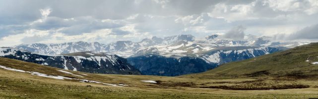
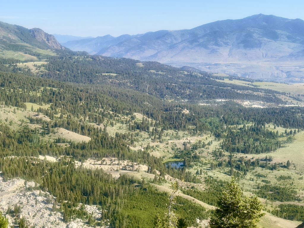
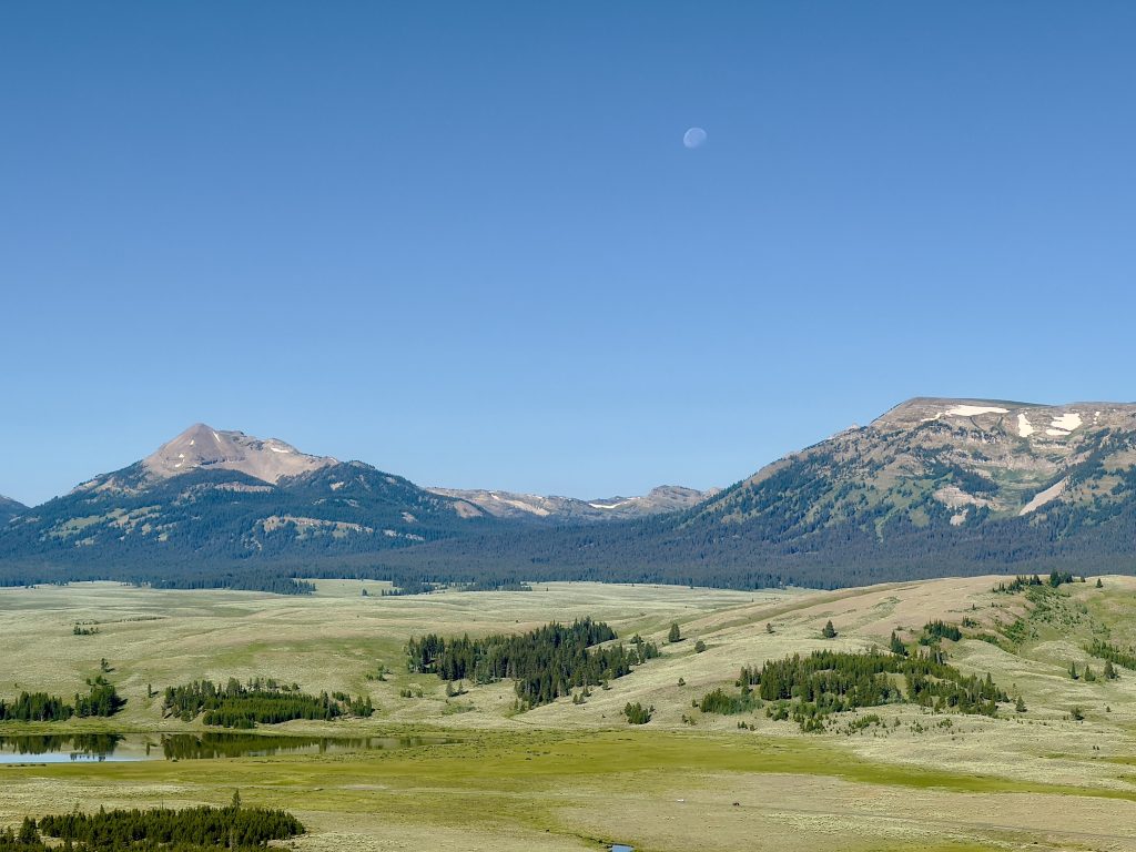
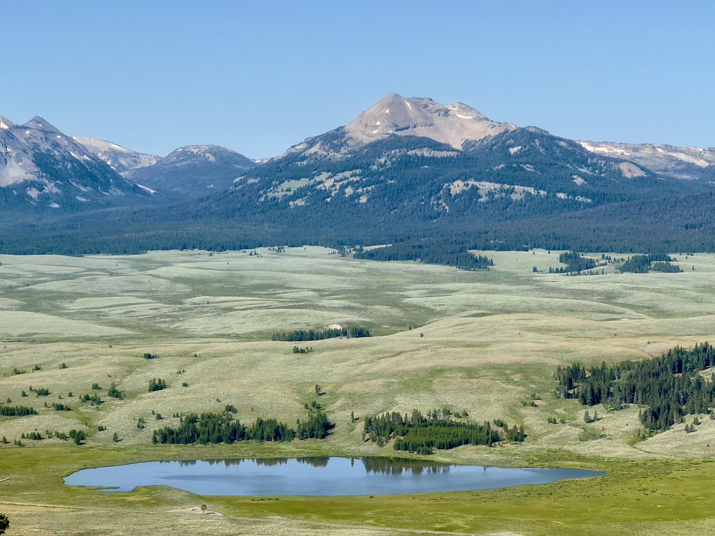
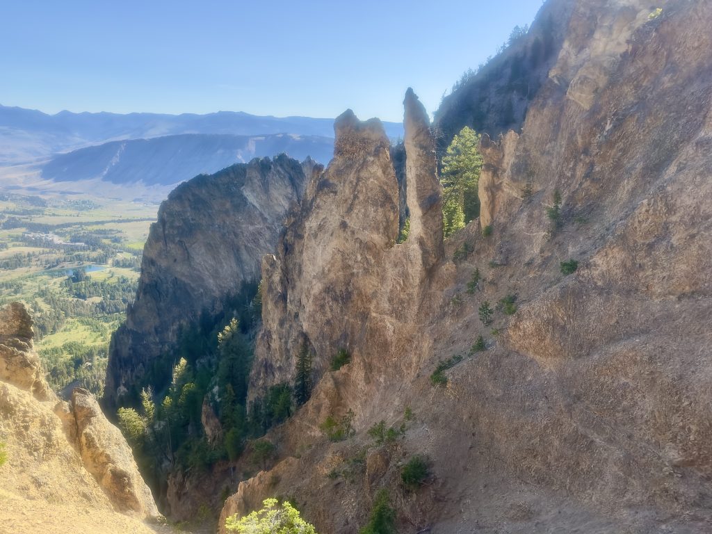
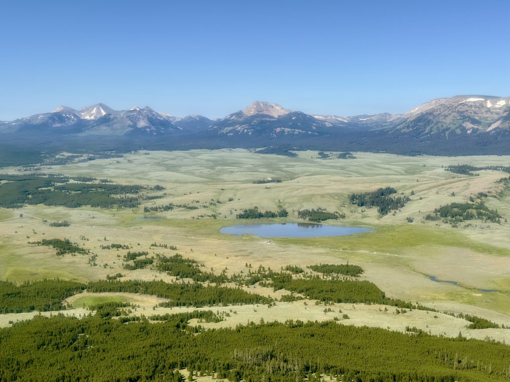
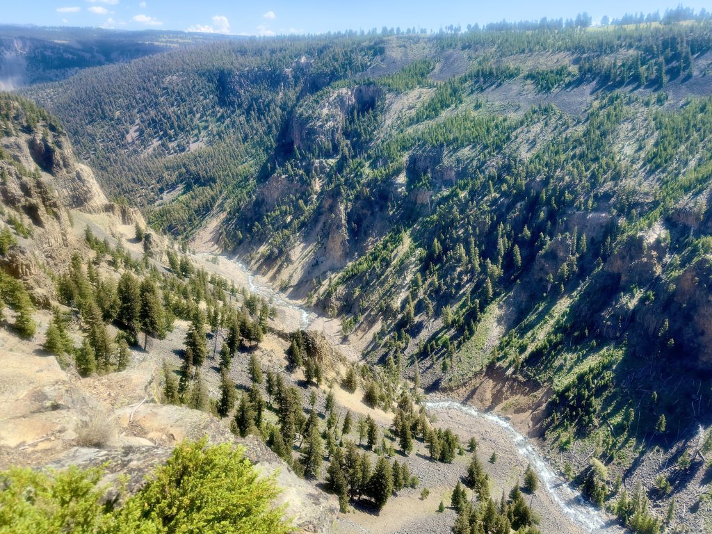
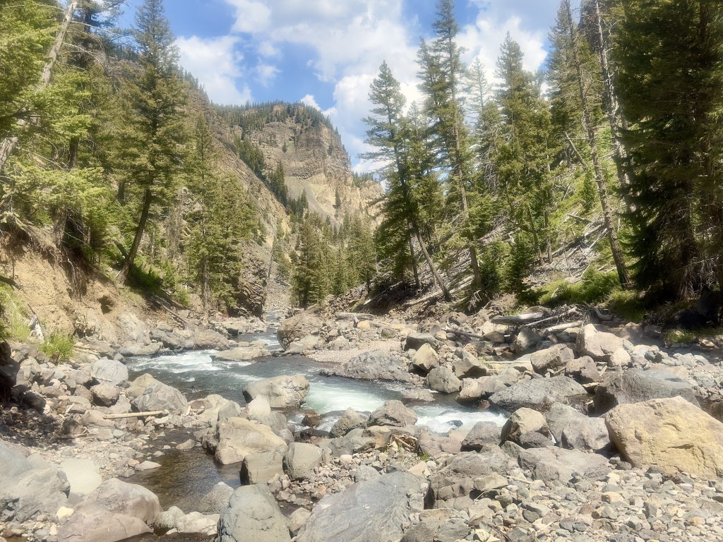
The moon remained visible until around 9:30 a.m. There were beautiful views of Swan Lake Flats, the Gallatin Mountain Range, Blacktail Deer Plateau, and the Yellowstone River Valley. The trail was not crowded, and I had an easy time with the switchbacks. About 1.5 miles up the trail, there is a rock formation known as Cathedral Rock.
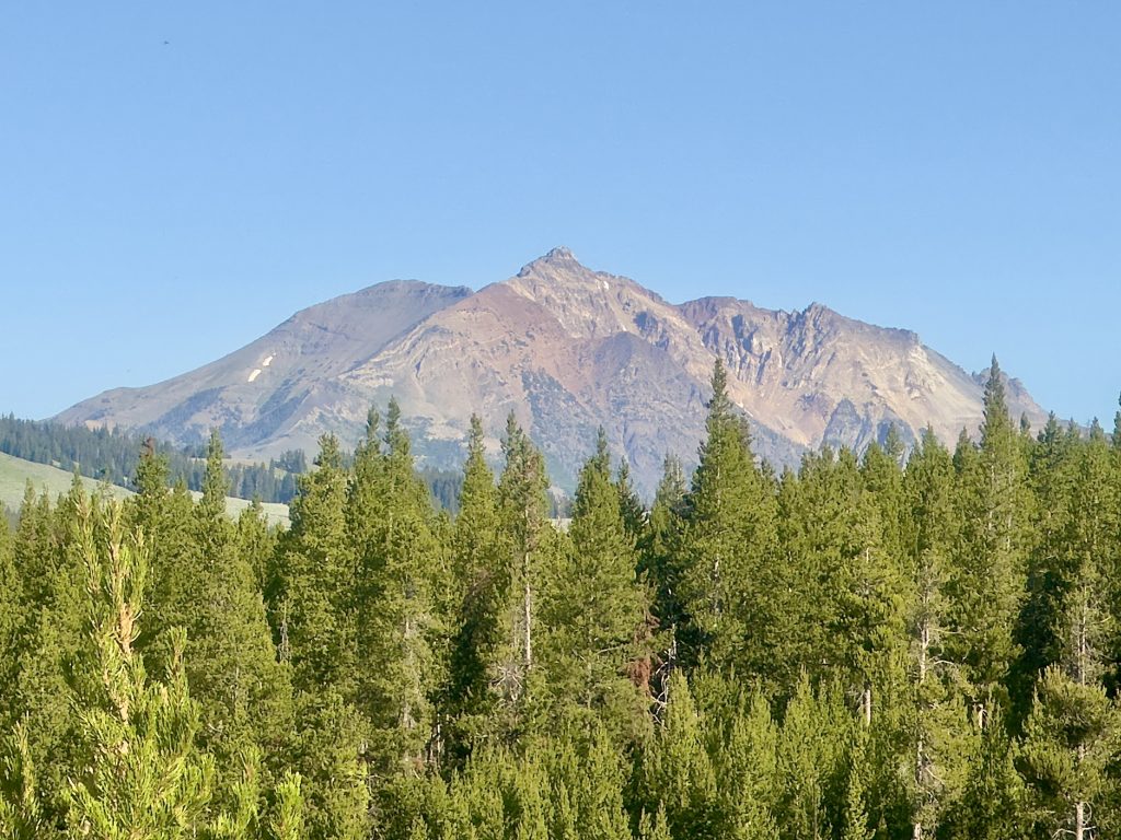
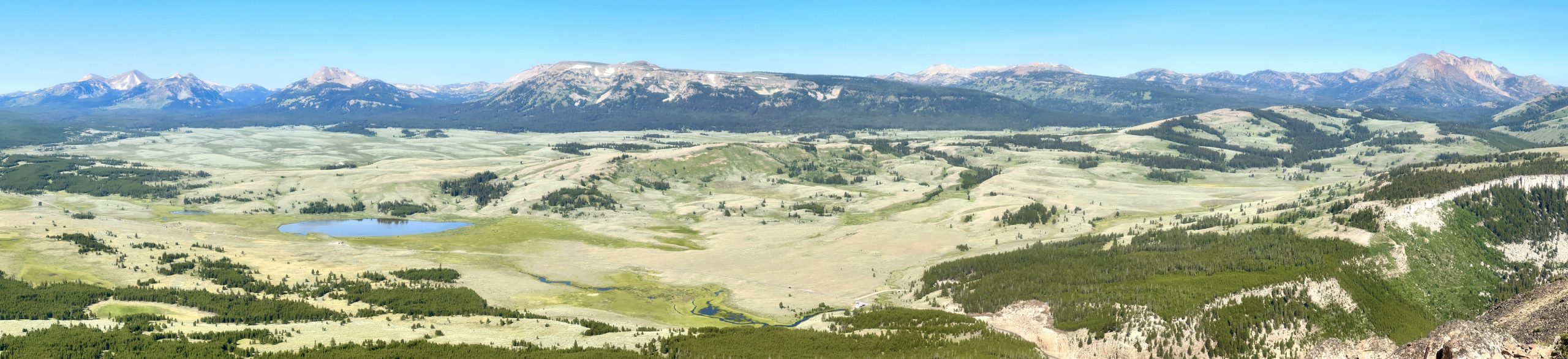
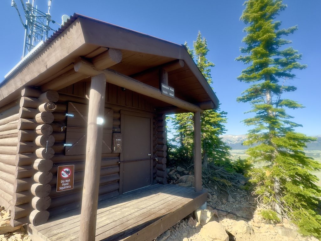
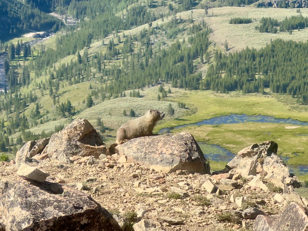
At Bunsen Peak’s 8,564-foot summit, there is a weather station and a hiker log. The only animal I saw was a marmot, and there were a lot of bugs, so I didn’t stay long.
Hiking down the east side of the mountain, the fire damage from 1988 is still evident, but the area has since opened up, allowing flowers and butterflies to flourish. The path narrows in certain spots, overtaken by spiky shrubs, so my advice would be to wear pants.
Click on images for captions.
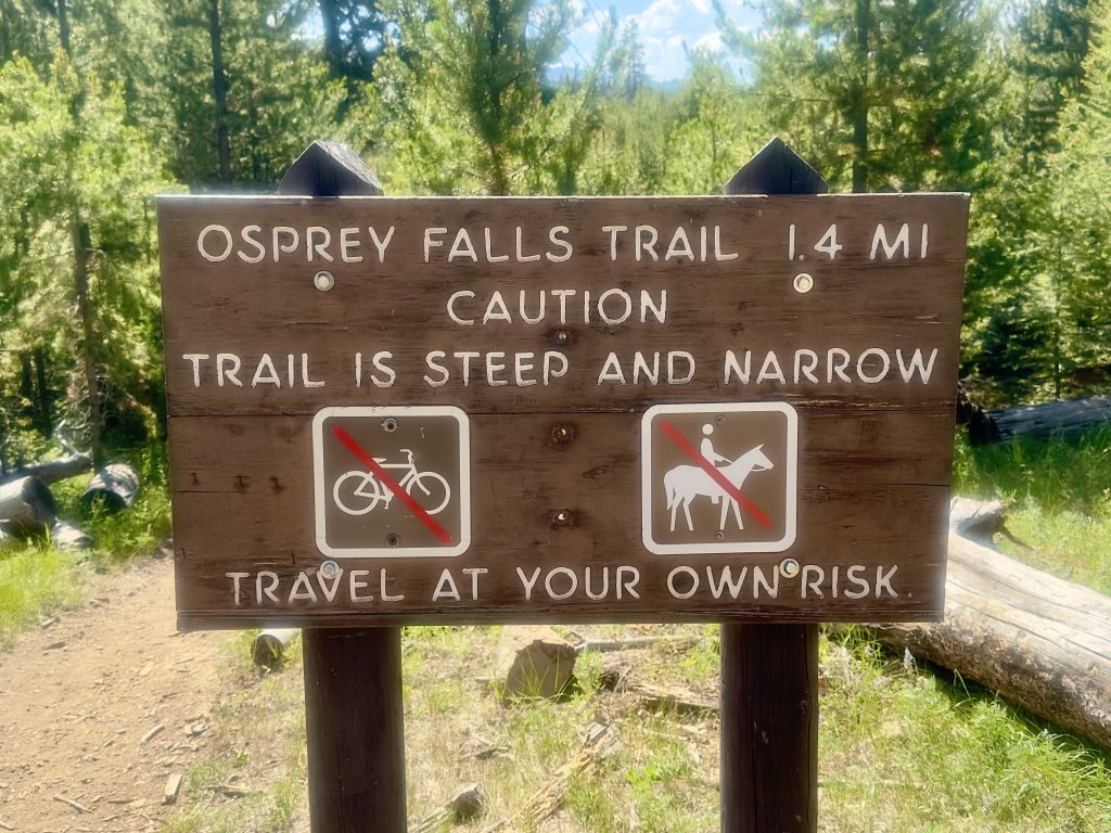
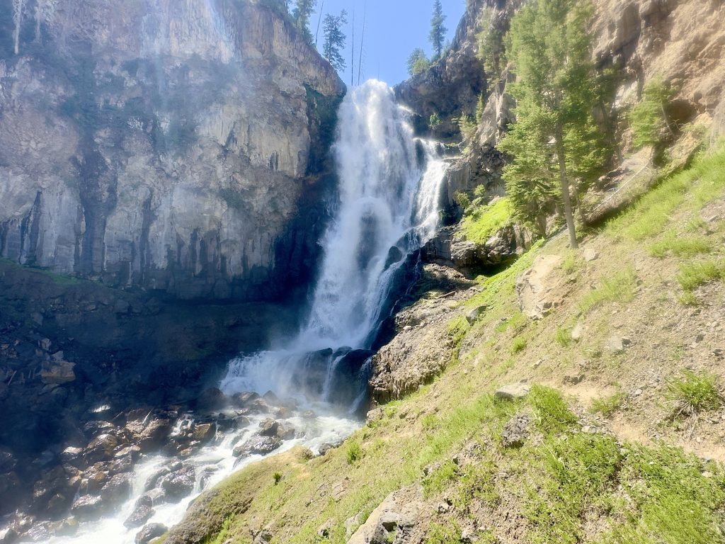
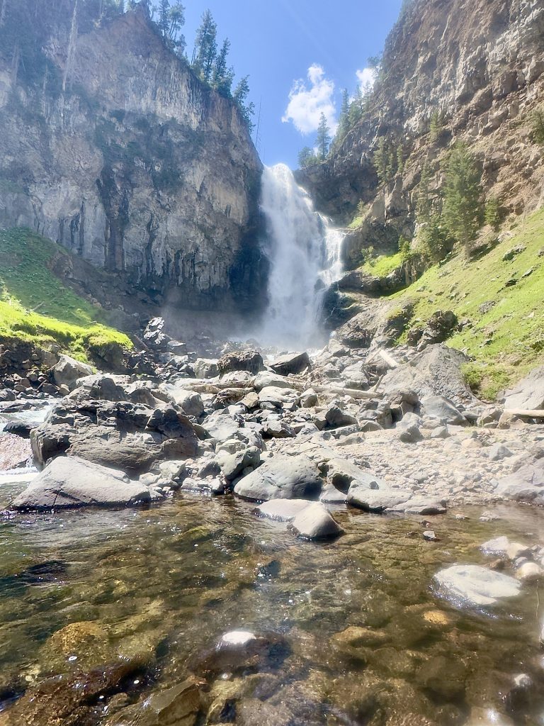
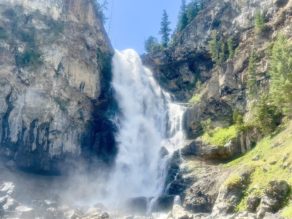
At the bottom, turn left onto Bunsen Peak Road (the backcountry trail where bikes are allowed) toward Sheepeater Canyon to reach Osprey Falls. The sign for Osprey Falls warns that the trail is steep and narrow, and that travel is at your own risk. Osprey Falls, located on the Gardner River, plunges 150 feet over the edge of a lava flow. I have to admit, the descent was difficult in some spots, so it helps to watch where you step, take your time, and wear hiking shoes with good traction. Once I reached the waterfall, I found a large rock to sit on and enjoy the view. After taking some photos, I went down to the river, dipped my feet in, and relaxed.
After soaking my feet and eating an apple, I continued on my journey. I took out my trekking poles, knowing that going up would be worse than going down—and it was. The temperature had risen by early afternoon, and it was hot with little shade. I took a lot of short breaks and needed more water than usual. My advice: bring plenty of water and sunscreen. There were wild raspberries along the trail, but it’s important to know your berries, as some can be poisonous.
When I returned to the Osprey Falls sign, I sat in the shade and drank more water. Looking up, I noticed dark clouds rolling in and heard thunder. I got up and continued the loop clockwise back to my car. There was a lot of thunder, but no rain, and the air turned cool and crisp. I kept taking pictures and took my time. A unique moth appeared, which I later identified as Hemileuca hera, or the sagebrush sheep moth. With about a quarter of a mile to go, I could see my car, and just then, it started raining—though not much. After I reached my car, put my stuff away, and got in, my clothes were dry.
Click on images for captions.
At 3:40 p.m., I drove to Mammoth Hot Springs and rewarded myself with a scoop of “Stuck in a Rut” Wilcoxson’s ice cream from the Yellowstone General Store.